From our field notes
Yucatán Road Trip by Rental Car: Itinerary, Topes, Cenotes and Ruins
Published 1 August 2026 · updated 1 August 2026 · 8 min read
By Clément Lacaille, publisher · our method
Flat, straight roads, short driving days, Maya ruins at every stop and thousands of cenotes: the Yucatán is arguably the easiest self-drive territory in Latin America. Provided you learn its rules of the game — the speed bumps that appear without warning, the near-empty toll highways, the unwritten ban on night driving and the pump attendant you should keep an eye on. Here is the 10-to-15-day loop from Cancún or Mérida, and everything worth knowing before you turn the key.
Why the Yucatán is the perfect first Latin American road trip
The peninsula combines everything that reassures a foreign driver: terrain that is almost perfectly flat — not a single mountain pass or hairpin —, a decent road network, short distances between stops (rarely more than two to three hours of driving per day) and generally readable signage. Yucatán and Campeche also rank among the safest states in Mexico, far removed from the areas foreign ministries advise against: Mérida's crime statistics compare with those of mid-sized European cities.
The classic loop links Cancún (or Mérida, which also has an international airport) to Valladolid, Chichén Itzá, Izamal, Mérida, the Ruta Puuc and Campeche, then optionally Bacalar and Tulum on the way back: roughly 1,500 km with the southern extension, 900 km without it. It fits comfortably into ten to fifteen days without ever turning the trip into a driving marathon.
The only real logistical constraint: a car becomes almost essential the moment you leave the Riviera Maya. Colectivos cover the main corridors, but the remote cenotes, the Ruta Puuc sites and yellow-painted villages like Izamal remain hard to reach without a steering wheel — which is precisely what keeps the crowds away from them.
The loop itinerary: 10 to 15 days, stage by stage
Driving counter-clockwise from Cancún has one advantage: it gets the most touristy stretch out of the way in the first days and saves the best — Mérida, the Ruta Puuc, Campeche — for the heart of the trip. From Mérida, simply reverse the logic. Either way, the golden rule is the same: short driving stints in the morning, sightseeing during the cooler hours, and never any driving after dark.
Here is the breakdown that works best over twelve to fifteen days; with only ten days, drop the Bacalar-Tulum extension and head straight back from Campeche on the free 180 highway.
- Days 1-3: Valladolid as base camp — nearby cenotes, the colonial centre, a side trip to Ek Balam
- Day 4: Chichén Itzá at opening time (8 am), then on to Izamal, the "yellow city"
- Days 5-7: Mérida — historic centre, markets, evenings on the Plaza Grande, optional day trip to the Gulf coast
- Days 8-9: The Ruta Puuc — Uxmal, Kabah, Sayil, Labná — with a night south of Mérida
- Days 10-11: Campeche, the UNESCO-listed walled city
- Days 12-13: The long crossing to Bacalar and its lagoon (the biggest driving day, around 360 km)
- Days 14-15: Tulum, then back to Cancún along the Caribbean coast
Valladolid and the cenotes — and Chichén Itzá strictly at opening time
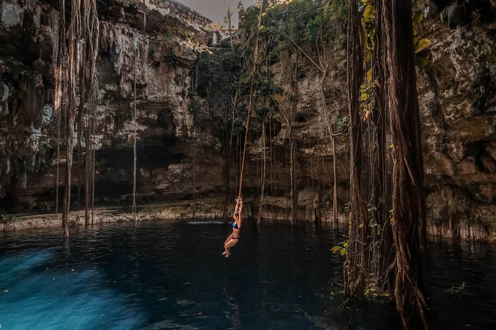
Valladolid is the best base camp for the start of the loop: a pleasant little colonial town, and above all dozens of cenotes within a thirty-minute drive — collapsed karst sinkholes of which the peninsula counts several thousand. This is where having a car really pays off: reaching a little-known cenote at 9 am, before the groups arrive, transforms the experience entirely. Showering before swimming is mandatory and sunscreen should be skipped altogether: cenote water connects directly to the aquifer that supplies the whole peninsula.
That precaution is anything but folklore. A study by Flor Arcega-Cabrera and colleagues published in 2023 in the Bulletin of Environmental Contamination and Toxicology measured water quality in four tourist cenotes of the Yucatán before and during Holy Week: microbiological and chemical indicators deteriorate significantly as swimmers pour in, within a karst system that has no adapted sanitation whatsoever (study: doi.org/10.1007/s00128-023-03761-1).
For Chichén Itzá, forty-five minutes from Valladolid, the strategy is simple and non-negotiable: be at the ticket booth at opening time, 8 am. The excursion buses from Cancún and the Riviera Maya unload their groups from 10.30-11 am onwards; before that, you have the site almost to yourself. Admission combines two tickets (federal plus Yucatán state), around 700 pesos per foreign adult in 2026, best paid in cash — the card terminals are temperamental.
Izamal and Mérida: the Yucatán of plazas and evening life
Between Chichén Itzá and Mérida, Izamal deserves more than a photo stop: the "yellow city", painted entirely ochre around its enormous Franciscan convent built on top of a Maya pyramid, makes for a peaceful half-day on foot. It is also an excellent lunch stop, far from the tour-bus restaurants clustered around Chichén Itzá.
Mérida, the state capital, is the loop's real surprise for many travellers: a lively, safe colonial city where you can walk at night, with free events almost every evening around the Plaza Grande and the Paseo de Montejo. Allow two to three nights — it is also the best base for day trips to the Gulf coast and its flamingos, or for planning the Ruta Puuc. The one driving caveat: the dense, one-way historic centre is a nightmare to park in; choose accommodation with parking and do everything on foot.
Ruta Puuc, Uxmal, Campeche: the part the buses ignore
South of Mérida begins the most rewarding self-drive section of the trip: the Ruta Puuc, a small country road stringing together Uxmal, Kabah, Sayil and Labná through the dry forest. Uxmal rivals Chichén Itzá architecturally — many find it superior — with a fraction of the visitor numbers: no tide of tour groups here, and secondary sites where you are sometimes completely alone in mid-morning.
Campeche, two hours further south-west, closes this section in style: a 17th-century fortified city on the UNESCO World Heritage list, its pastel façades beautifully restored, still largely untouched by mass tourism. It is the westernmost point of the loop and worth one or two nights, before the strategic choice of the return leg: straight back east on the free highway, or the long southern extension towards Bacalar.
The southern extension: Bacalar and Tulum, eyes wide open
The Bacalar lagoon, known as the "lagoon of seven colours", justifies the long crossing from Campeche all by itself (around 360 km, the biggest driving day of the itinerary — worth splitting with an overnight stop if needed). Its translucent freshwater and its stromatolites — microbial colonies among the oldest life forms on the planet — make it as spectacular as it is fragile: swim without sunscreen, motors are restricted, and never step on the formations.
Tulum, the last stop before Cancún, is the exact opposite of the rest of the loop: superbly located ruins facing the sea, but crowds and prices unmatched anywhere else on the peninsula. The tourist pressure there is also shifting inland: a study by Diego Casas-Beltrán and colleagues published in 2020 in the journal Sustainability showed that massive sargassum seaweed strandings on Riviera Maya beaches are redirecting visitors towards the cenotes, with measurable water contamination and still very weak regulation (study: doi.org/10.3390/su12062474). All the more reason to visit this coast's cenotes early in the morning — or to favour the quieter ones around Valladolid instead.
Driving in the Yucatán: topes, cuota and free roads
The tope is the quintessential Mexican road institution: a massive speed bump, often unsigned, sometimes unpainted, placed at the entrance and exit of every village — and occasionally in the middle of a straight. Hit at 60 km/h, it can damage the steering or blow a tyre on a small rental car. The reflex to acquire on day one: lift off as you approach any inhabited area, and watch what the local cars are doing — they always brake before you can see the tope.
The network splits into two worlds. The cuota (toll) highways, like the 180D between Cancún and Mérida, are fast, safe and almost empty — around 645 pesos for the full Mérida-Cancún run in 2025, paid in cash at the toll plazas. The free roads (libres) cost nothing and thread through the villages with their procession of topes, but they also offer the only shops, restaurants and petrol stations along the way: services on the cuota are extremely scarce, so always set off with a full tank.
One rule, finally, is unanimous among Mexico regulars: you do not drive at night, the Yucatán included. Not so much because of crime — low in the peninsula — as because of the cocktail of invisible topes, stray animals, unlit cyclists and vehicles driving without lights. Every stage of this itinerary fits comfortably into daylight hours.
| Criterion | Cuota toll highway (180D) | Free road (180 and secondary roads) |
|---|---|---|
| Cost | Tolls (approx. 645 pesos Mérida-Cancún in 2025, cash only) | Free |
| Topes | None | Frequent, often unmarked |
| Cancún-Mérida time | About 3.5 hours | 5 hours or more, depending on villages |
| Petrol stations | Very scarce: leave with a full tank | Regular in the towns |
| Scenic interest | None — pure efficiency | Villages, local life, easy stops |
Fuel, police, insurance: the three things to watch
In Mexico you never pump your own fuel: an attendant fills the tank, may wash the windscreen, and expects a small tip of a few pesos. Two classic scams target tourists: the pump not reset to zero before serving you — always check the display reads "0" before the nozzle goes into the tank — and the banknote switcheroo, where the 500-peso note you handed over becomes a 50 in the attendant's hand. The simple counter: announce out loud the denomination you are handing over, and pay with small notes whenever possible.
Police checkpoints are frequent around Cancún, Tulum and at state lines: the vast majority pass without incident. Keep your licence, passport (or a copy) and the car's papers within reach, stay courteous, and if you are accused of an offence, always ask for a written ticket to be paid officially — the request alone is usually enough to make fanciful "fines" evaporate.
On insurance, one point is non-negotiable: Mexican third-party liability (RC) cover is required by law, and credit card coverage never replaces it. It is the line item that explains the spectacular gap between rental companies' teaser prices and the real bill at the counter — we have dedicated a detailed article to it, essential reading before you book.
When to go: hurricanes, heat and sargassum
The Atlantic hurricane season officially runs from 1 June to 30 November, with a marked peak in September-October: those are the two months to avoid first, less for the risk of a major hurricane — rare in any given year — than for the torrential rain and humidity that can spoil both sightseeing and swimming. At the other extreme, April and May are the hottest months: 38 to 40°C are common in Mérida before the first rains, making the archaeological sites gruelling from late morning onwards.
The ideal window runs from November to March: dry weather, 28 to 32°C by day, pleasant evenings. It is also high season — expect higher rental and accommodation rates around Christmas and in February-March — but on this itinerary only Tulum and Chichén Itzá truly saturate; Mérida, the Ruta Puuc and Campeche stay comfortable all season long. Sargassum, finally, only affects the Caribbean coast (Tulum, Riviera Maya), mostly from April to August: the cenotes and the Bacalar lagoon are untouched by the problem.
Free decoder
The Mexico & Costa Rica car rental insurance decoder
TPL / seguro obligatorio no counter can remove, CDW-LDW, the deducible, the blocked deposit, comparison-site teaser rates: our decoder goes through the Mexican or Costa Rican quote line by line, with the check-out checklist and the 5 questions to ask before paying. Instant access, with the current promo code.
No time to do it yourself?
A professional can take care of it: tailor-made trip, equipped 4x4 rental or a local guide. Describe your plans and, with your consent, we pass them on to partner professionals.
1. What you need
Before you go
Readers' questions
How many days do you need for a Yucatán road trip?
Allow a minimum of 10 days for the Cancún - Valladolid - Chichén Itzá - Mérida - Ruta Puuc - Campeche loop, and 14 to 15 days to add Bacalar and Tulum. With fewer than 10 days, it is better to stick to the Valladolid - Mérida - Uxmal triangle from Mérida airport.
Is it dangerous to drive in the Yucatán?
No: Yucatán and Campeche rank among the safest states in Mexico, and the peninsula's roads are flat and in good condition. The real risks are on the road itself: unmarked topes, stray animals and unlit vehicles — hence the absolute rule of never driving after dark.
Should you take the toll highways (cuota)?
For long hops like Cancún-Mérida, yes: the 180D is fast, safe and tope-free, for around 645 pesos in total in 2025 (cash only, and leave with a full tank as petrol stations are scarce on it). For shorter stages, the free roads are livelier and cost nothing — as long as you slow down through every village.
What is the best time of year for this road trip?
November to March: dry weather and 28 to 32°C by day. Avoid September-October, the heart of the hurricane and rainy season, and be wary of April-May, the hottest months, when Mérida routinely tops 38°C.