From our field notes
Driving to Monteverde: Road Conditions, Do You Need a 4x4, Reserves and Tickets
Published 1 August 2026 · updated 1 August 2026 · 8 min read
By Clément Lacaille, publisher · our method
It's THE question that comes up on every forum before a Costa Rica road trip: can you drive up to Monteverde, perched in the cloud forest at 1,400-1,600 m, in an ordinary rental sedan, or do you absolutely need a 4x4? The answer has shifted in recent years, because the main access road has been paved. But it still depends on which route you take and the season. Here are the conditions on all three access roads, the real drive times, and what awaits you once you're up there, reserves and tickets included.
The 4x4 question: what has changed
For decades, getting up to Monteverde was an ordeal: miles of rocky dirt road, washboard corrugations, potholes, and a stubborn reputation as a "car-breaker." Hence the still-common reflex of booking a 4x4 just in case. That reflex deserves a rethink today: the main access route, National Route 606 from the Interamericana Highway, has been paved along most of its length all the way to the center of Santa Elena, the town that serves as the gateway to the whole region.
The upshot: depending on the route you choose, an ordinary passenger car may now be enough, where a 4x4 was once all but essential. So the real issue is no longer "4x4 or not" in the abstract, but "which road, in which season, with which vehicle." That framing is what lets you make the right call without overpaying or taking a needless risk.
A word on vocabulary so you don't get lost: "Monteverde" refers both to the cloud forest region and to one of its reserves; the village where you stay and from which most excursions depart is called Santa Elena. The two names are often used interchangeably, but they don't point to exactly the same place.
Route 606 from the Interamericana: the now-paved access
This is the recommended route from San Jose and the Pacific coast. You take Highway 27, then join the Interamericana (Route 1), which you follow northwest to the Route 606 turnoff, near Rancho Grande. From there, the 606 climbs toward Santa Elena. Where it was still a long dirt road just a few years ago, it is now asphalted or concreted along nearly the entire way to the center of the village.
Careful, though: "paved" does not mean "easy." The 606 remains a narrow, winding mountain road, steep in places, with no guardrails or lighting over long stretches, and no rumble strips or continuous road markings. The surface is smooth, but vigilance is essential, especially in the drizzle or fog that are frequent at altitude. Drive slowly, anticipate the hairpin bends, and absolutely avoid doing this climb at night for the first time.
From San Jose airport, allow roughly 3 to 3.5 hours in normal conditions, the entire route now being paved. For this journey, a well-maintained passenger car handles it without trouble in the dry season; an SUV with slightly raised ground clearance is more comfortable, without being an absolute necessity.
From La Fortuna: Tilaran or Rio Chiquito
The La Fortuna-Monteverde link is one of the most traveled in the country, because these two highlights are almost always strung together in the same itinerary. You have two very different road options. The most common one loops around the north side of Lake Arenal and passes through Tilaran: the La Fortuna-Tilaran stretch is in good condition, but the Tilaran-Monteverde section deteriorates noticeably, with rough sections and potholes, especially in the final part. Allow 3 to 4.5 hours depending on rain and stops.
The other, shorter option runs along the south side of the lake via El Castillo and the Rio Chiquito area. It saves about thirty minutes, but it is a genuine dirt track: it is only reasonably passable in a 4x4, and mainly in the dry season (roughly December to April), when the water level of the streams you have to cross is low. Outside that window, best to forget it and go back around via Tilaran.
A third route, without a car this time: the "taxi-boat-taxi" formula, which crosses Lake Arenal by boat with a shuttle on each side. It doesn't concern the self-drive traveler, but it explains why many visitors choose to drop off their vehicle on one side and pick up another on the other: it is sometimes faster and less tiring than the road.
Do you really need a 4x4? The real reasoning
Technically, on the main 606 access in the dry season, the honest answer is: no, a 4x4 is not essential. A passenger car makes the climb without a hitch. But several reasons explain why rental companies and guides continue to recommend an SUV or a 4x4 with raised ground clearance, and they are not all commercial.
The first is seasonal: at the height of the green season, particularly October and November, the secondary tracks (Rio Chiquito, roads to certain farms or isolated lodgings) become slippery and rutted, to the point of being impassable without four-wheel drive. The second is ground clearance: even paved, the region is still riddled with degraded sections, abrupt speed bumps and uneven shoulders where a low chassis scrapes quickly. The third is insurance-related: many rental contracts in Costa Rica exclude damage sustained "off-road" or on unpaved tracks — driving where your vehicle category is not intended to go can leave you with no coverage.
In practice, the right call boils down to this:
- Access only via the 606 from the Interamericana, in the dry season, with no detour onto dirt roads: a passenger car is enough.
- Travel in the green season (May-November), or lodging outside the village on a dirt road: go for an SUV with raised ground clearance.
- Taking the Rio Chiquito track from La Fortuna: 4x4 mandatory, and dry season only.
- In all cases: check exactly what your insurance covers on unpaved roads before committing to a track.
Real drive times and recommended vehicle
The times shown by GPS apps are often optimistic: they ignore the hairpin bends, the degraded sections and the drizzle that slows everyone down. The table below gives realistic ballpark figures depending on your starting point and route, in normal conditions.
| Departure / route | Realistic duration | Recommended vehicle |
|---|---|---|
| San Jose → 606 (Interamericana) | 3 to 3.5 h | Passenger car (SUV more comfortable) |
| La Fortuna → Tilaran | 3 to 4.5 h | SUV with raised ground clearance |
| La Fortuna → Rio Chiquito | ≈ 30 min less than via Tilaran | 4x4, dry season only |
| Pacific coast (Guanacaste) → 606 | 2.5 to 3.5 h | Passenger car (SUV more comfortable) |
On site: Monteverde, Santa Elena and the hanging bridges
Once you're up there, three main sites compete for visitors' time. The Monteverde Biological Reserve is the most famous: dense, lush, but also the busiest, with entry quotas. The Santa Elena Reserve, smaller and less frequented, offers a quieter experience and, on a clear day, fine views toward the Arenal volcano. Finally, the hanging bridges parks let you walk through the canopy at treetop level — a different, more contemplative than naturalist approach.
As for prices, in 2026 expect ballpark figures of around 25 to 29 USD for adult admission to the Monteverde Reserve, and around 18 to 22 USD for Santa Elena — the latter remaining the more economical. Both reserves generally open from 7 a.m. to 4 p.m. These amounts change regularly: always check the current official rate when you book.
Booking online is strongly advised, especially at the Monteverde Reserve, which caps the number of places per time slot: in high season (December-April and July-August), the morning entries go fast. Booking ahead avoids finding yourself at a sold-out gate after three hours of mountain driving. For wildlife watching, aim for opening time, when bird activity is at its peak and the crowds are still thin.
Cloud forest weather: wind, drizzle and altitude
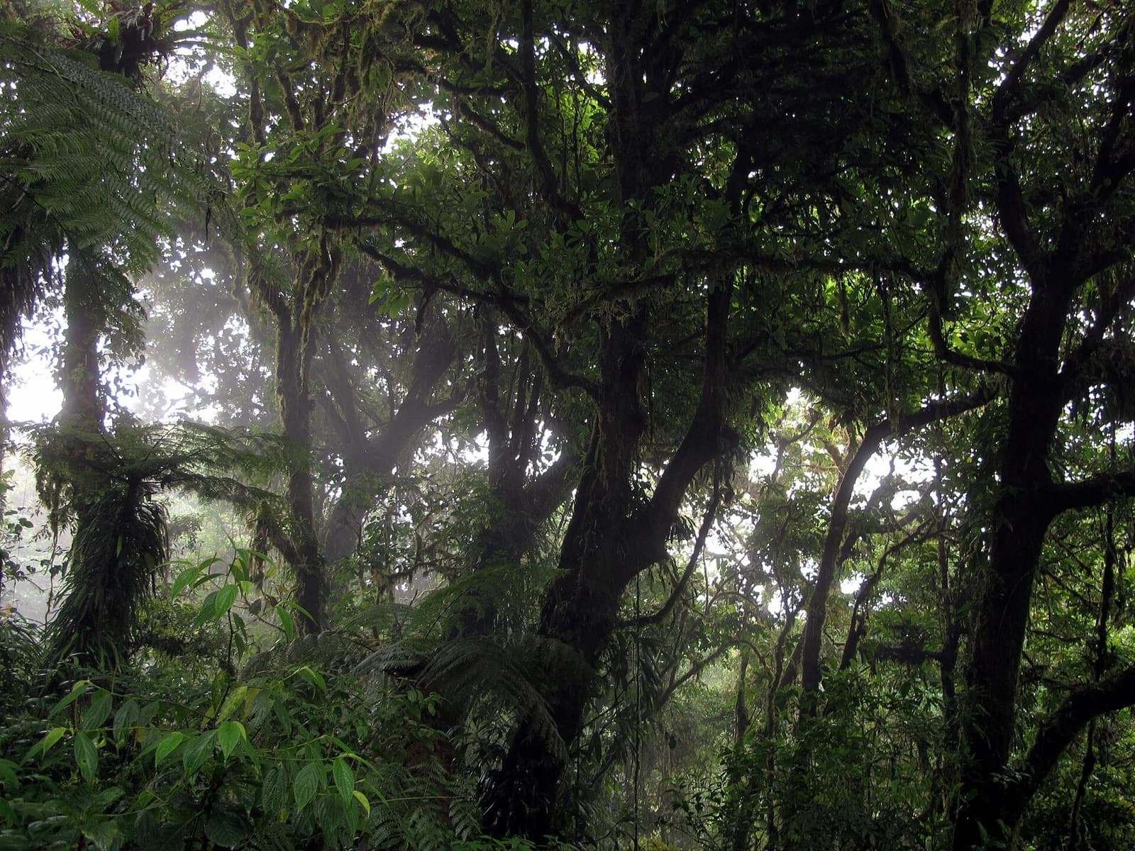
Monteverde does not have the beach climate you associate with Costa Rica. At 1,400-1,600 m, the region lives in the clouds: steady wind on the ridges, near-constant drizzle (the famous "bajareque"), high humidity and cool temperatures, often 15-20°C, that surprise travelers arriving from the coast in a T-shirt. A waterproof windbreaker, a warm layer and grippy shoes are not options but basic kit, whatever the season.
This fog is not a weather whim: it is the very engine of the ecosystem. A study by Still, Foster and Schneider published in 1999 in the journal Nature modeled the effect of warming on tropical cloud forests and showed that rising temperatures tend to lift the altitude of the cloud base, reducing the contact time between the canopy and the moisture it depends on (study: doi.org/10.1038/19293).
The biological side of this phenomenon has been documented at Monteverde itself. A study by Pounds, Fogden and Campbell, also published in 1999 in Nature, linked the dramatic decline in dry-season mist frequency since the mid-1970s to the collapse of amphibian and bird populations in the region, including the disappearance of the emblematic golden toad (study: doi.org/10.1038/19297). Enough to appreciate, as you walk through the drizzle, just how much this moisture makes the forest.
So, when should you go?
The dry season (December to April) offers the safest driving conditions on all access routes, including the Rio Chiquito track, and the most breaks of clear sky between passing clouds. It is also high season: reserves, lodgings and morning slots fill up, hence the value of booking your tickets ahead. A passenger car is then enough for the main access.
The green season (May to November) makes the forest greener, more alive and less crowded, but complicates the secondary tracks: October and November, the wettest months, are when a 4x4 truly makes the difference if you leave the pavement. Whatever the month, arrive in daylight, drive carefully on the final climb, and keep in mind that the real challenge of Monteverde is no longer the condition of the main road, but the mountain, the rain and the darkness, which do demand a measured hand at the wheel.
Free decoder
The Mexico & Costa Rica car rental insurance decoder
TPL / seguro obligatorio no counter can remove, CDW-LDW, the deducible, the blocked deposit, comparison-site teaser rates: our decoder goes through the Mexican or Costa Rican quote line by line, with the check-out checklist and the 5 questions to ask before paying. Instant access, with the current promo code.
No time to do it yourself?
A professional can take care of it: tailor-made trip, equipped 4x4 rental or a local guide. Describe your plans and, with your consent, we pass them on to partner professionals.
1. What you need
Before you go
Readers' questions
Can you get to Monteverde without a 4x4?
Yes, by taking the main access, Route 606 from the Interamericana, now paved along most of its length to Santa Elena: a passenger car makes the climb without difficulty in the dry season. An SUV with raised ground clearance is more comfortable, and a 4x4 becomes useful in the green season or if you take secondary dirt tracks.
How long is the drive between La Fortuna and Monteverde?
Allow 3 to 4.5 hours via the classic route that loops around Lake Arenal through Tilaran, depending on rain and stops. The Rio Chiquito track, on the south side of the lake, saves about thirty minutes but requires a 4x4 and is only passable in the dry season.
How much does entry to the Monteverde reserves cost?
In 2026, expect ballpark figures of around 25 to 29 USD for adult admission to the Monteverde Reserve, and around 18 to 22 USD for the more economical Santa Elena Reserve. Both generally open from 7 a.m. to 4 p.m. Always check the current official rate, as it changes regularly.
Do you need to book tickets in advance?
Yes, especially for the Monteverde Reserve, which caps the number of entries per time slot. In high season (December-April, July-August), morning slots go fast. Booking online avoids finding the gate sold out after several hours of mountain driving.