From our field notes
Norway's Atlantic Road: driving the Atlanterhavsvegen
Published 25 July 2026 · updated 25 July 2026 · 7 min read
By Clément Lacaille, publisher · our method
The Atlantic Road (Atlanterhavsvegen) is arguably Norway's most photographed road: 8 km of carriageway leaping from islet to islet across a string of bridges, including the famous Storseisundet that seems to hurl itself into the void. In fine weather it's a fairy-tale drive above a turquoise sea; in a storm, a spectacle where waves sweep the asphalt. Here's how to drive it safely, when to go to experience it fully, and why its grandiose setting is also an attention trap for the driver.
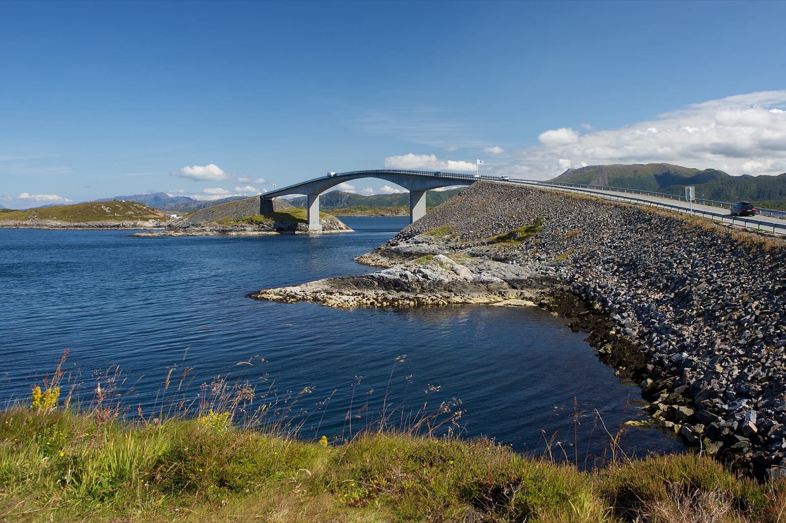
Where it is and what it's like
The Atlanterhavsvegen links the municipalities of Molde and Kristiansund on Norway's west coast, spanning an archipelago of reefs between Averøya island and the mainland. The spectacular stretch is just 8.3 km (route Fv64) and takes about ten minutes without stopping — but nobody drives it without stopping. Eight bridges follow one another, including Storseisundet, whose dizzying curve has given the illusion, in a thousand photos, of a road plunging into the sea.
Opened in 1989 after a build hit by twelve storms, the road is one of Norway's 18 "National Scenic Routes", fitted with design rest areas and panoramic platforms. It combines ideally with the western fjords region: Trollstigen, Geiranger and Åndalsnes are within a day's reach.
The setting that steals your gaze: drive focused
The paradox of this road is that its very beauty is a risk factor: the carriageway is narrow, with no hard shoulder, and the driver is drawn to the bridges and the sea horizon. A systematic review published in 2023 in Transport Reviews synthesised the effects of the roadside visual environment on driver behaviour, confirming that visually loaded scenes alter speed, trajectory and time spent looking away from the road.
The fix is simple: the driver watches the road, the passengers watch the scenery. To photograph, stop at one of the laid-out areas (Eldhusøya, Askevågen) rather than slowing on the open carriageway. In high season, motorhome and cyclist traffic demands extra vigilance on this escape-free stretch.
Fine weather or storm: two opposite experiences
Under clear skies, the road offers unreal light and colours, ideal from May to August when days are long. But many travellers come precisely for the opposite: in autumn and winter, Norwegian Sea storms throw sheets of water over the bridge decks, a striking spectacle — to admire from a safe area, never by stopping on the carriageway.
In a strong storm, the road can be temporarily closed for safety: check conditions on vegvesen.no before committing in winter. Crosswind, which frequently exceeds troublesome gusts on the bridges, is the real danger for a high vehicle like a motorhome or camper van.
| Season | Mood | Driving | Plan for |
|---|---|---|---|
| May-Aug | Long light, calm sea | Easy, dense traffic | Book accommodation early |
| September-October | First storms, colours | Wind, wet carriageway | Waterproof jacket, patience |
| November-March | Storms, waves on the bridges | Strong crosswind, possible closures | Check vegvesen.no |
Travel tips
Get our independent-travel tips by email
The house methods — costed budgets, driving, itineraries — straight to your inbox. Instant bonus: our free excerpt “The 7 mistakes to avoid on a first Namibia road trip” and the current promo code.
No time to do it yourself?
A professional can take care of it: tailor-made trip, equipped 4x4 rental or a local guide. Describe your plans and, with your consent, we pass them on to partner professionals.
1. What you need
Before you go
Readers' questions
How long do you need for the Atlantic Road?
The spectacular stretch is just 8.3 km and drives in about ten minutes, but allow 1 to 2 hours with stops at the panoramic areas (Eldhusøya, Askevågen) to walk and photograph the bridges.
Is it dangerous to drive?
Not in fine weather, but the carriageway is narrow with no hard shoulder, and the scenery pulls your attention. The driver must stay focused on the road and let passengers admire. In a storm, crosswind and waves demand caution, or even a closure.
When can you see waves washing over the road?
In autumn and winter, during Norwegian Sea storms, sheets of water break over the bridges. It's spectacular from a safe area, but check conditions on vegvesen.no first, as the road may be closed.
Can you combine the Atlantic Road with the fjords?
Yes, easily. It sits near Molde and Kristiansund, within a day's reach of Trollstigen, Geiranger and Åndalsnes, the heart of Norway's western fjords region.