From our field notes
The Lofoten Islands by Car: The E10 Itinerary, How Many Days, Which Season?
Published 1 August 2026 · updated 1 August 2026 · 8 min read
By Clément Lacaille, publisher · our method
Granite peaks rising straight out of the sea, falu-red fishermen's cabins on stilts, white-sand beaches at 68° north: the Lofoten Islands pack Norway's most spectacular scenery into 130 kilometres of road. The E10 runs the length of the archipelago, from Å to Svolvær, and lends itself perfectly to a self-drive road trip — provided you arrive prepared: ferry booked, a realistic number of days, and a season chosen with your eyes open. Here is how to build the itinerary.
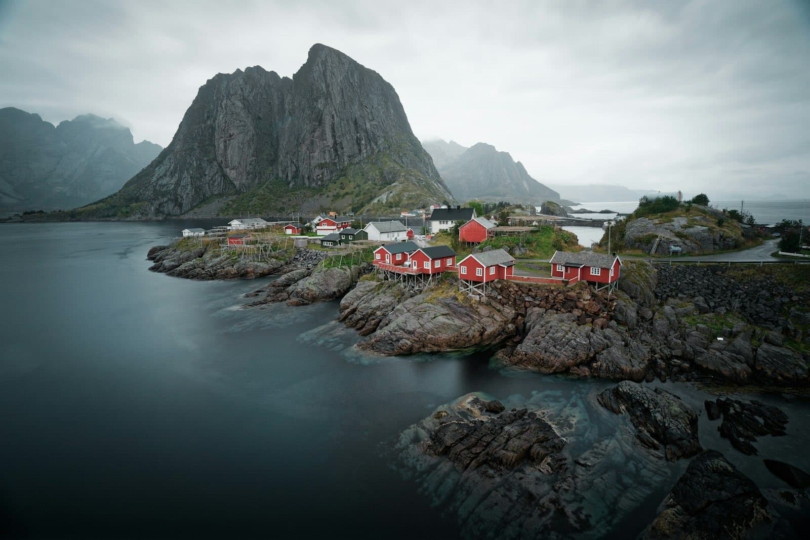
The E10, backbone of the archipelago
In Lofoten there is essentially one road: the E10, which links the village of Å — at the very end of the archipelago, where the tarmac literally stops — to Svolvær, the "capital", in roughly 130 kilometres, before continuing to the mainland via Vesterålen and Narvik. Bridges, undersea tunnels and causeways string together the islands of Moskenesøya, Flakstadøya, Vestvågøya and Austvågøya without a single intermediate ferry: you can drive the whole route in either direction, door to door.
That single ribbon of road is both a blessing and a trap. A blessing, because almost every kilometre delivers a view; a trap, because 130 kilometres on the map suggests a half-day stage. In reality, between the dead-end detours to fishing villages, the photo stops and the hikes, Lofoten's E10 is best savoured at a pace three to four times slower than an ordinary road.
This isn't just a traveller's impression: a study by Denstadli and Jacobsen published in 2011 in Tourism Management, based on Norwegian scenic tourist routes, shows that self-drive tourists' satisfaction depends as much on the quality of roadside facilities — viewpoints, lay-bys, toilets — as on the landscape itself (study: doi.org/10.1016/j.tourman.2010.06.014). Lofoten has those facilities: use them rather than stopping just anywhere.
Getting there: plane, ferry or road
Three gateways serve the archipelago. The fastest: fly straight into Leknes or Svolvær, two small airfields served by propeller aircraft via Bodø — convenient but often expensive, with a limited car-rental fleet that needs booking very early. The most common: Harstad-Narvik/Evenes airport, with direct flights from Oslo, from which you reach Svolvær along the E10 in about 165 kilometres and 2.5 to 3 hours of driving — an approach spectacular enough to count as a warm-up.
The most iconic option remains the Bodø–Moskenes ferry: a crossing of roughly 3 hours 15 minutes to 3 hours 30 minutes that lands you at the foot of Reine. In 2026, expect 605 NOK (around €50) for a car under six metres and 424 NOK for an electric car; the boarding guarantee ("plassgaranti") costs an extra 250 NOK per vehicle. The crucial point: in high season only part of the capacity is sold in advance, and summer crossings sell out weeks ahead — booking as soon as your dates are fixed isn't optional, it's the condition of the trip.
Finally, you can do it all by road from the mainland via Narvik: longer, but with no booking constraint, and a chance to cross Vesterålen on the way. It's the logical option for anyone folding Lofoten into a larger Norwegian road trip.
From Å to Svolvær: the thread of the itinerary
Driving south to north, straight off the ferry at Moskenes, is the most natural direction: you start with the densest stretch. Å, a museum-village at the end of the road, then Reine, set on its fjord — arguably the most photographed view in Norway — and the Reinebringen viewpoint above it: 448 metres climbed via a staircase of roughly 1,978 steps built by Nepalese Sherpas, completed in 2021 precisely to contain the erosion caused by visitor numbers. Allow 1.5 to 2 hours return, steep but secure in dry weather.
Next come Hamnøy and its red cabins on the rocks — the bridge above them is one of the archipelago's busiest photo spots — then the detour to Nusfjord, one of Norway's best-preserved fishing villages, at the end of a small dead-end road. On Flakstadøya, Ramberg beach delivers the first taste of the local paradox: white sand and turquoise water beneath snow-dusted summits.
The second half plays out on Vestvågøya and Austvågøya: the twin beaches of Haukland and Uttakleiv, linked by a coastal path, the detour to Unstad — a renowned Arctic surf spot — then Henningsvær, a fishing village spread across islets joined by single-lane bridges, famous for its football pitch laid straight onto the granite. Svolvær and the silhouette of the Svolværgeita close the traverse.
The detours and hikes worth your time
Lofoten is earned on foot as much as behind the wheel: the finest viewpoints cannot be seen from the E10. Four detours structure most successful itineraries.
- Reinebringen (448 m): the Sherpa staircase above Reine, 1.5 to 2 hours return — go early morning or late evening in summer to avoid the queue.
- Kvalvika and Ryten (543 m): the wild beach reachable only on foot from Fredvang, then the summit overlooking it — the most rewarding half-day in the archipelago.
- Nusfjord: a preserved fishing village at the end of a dead-end road, best visited late in the day once the coaches have left.
- Haukland–Uttakleiv: two beaches linked by an easy coastal path of about an hour, ideal on windy days when the mountains are best avoided.
- Unstad: the Arctic surfers' bay, spectacular in an autumn or winter swell.
How many days do you need?
It's the classic mistake: seeing "130 km" on the map and giving Lofoten two days. At that pace you spend the whole trip driving from one full car park to the next without ever walking. The realistic minimum is 4 to 5 days on the islands, excluding travel to and from: two nights in the south (the Reine–Moskenes area), two in the north (Leknes–Henningsvær–Svolvær), with one hike per day and slack built in for the weather.
A full week changes the nature of the trip: it lets you wait for a weather window for Ryten or Reinebringen — in Lofoten the sky can change three times in a day —, add Unstad or a boat trip, and sleep in different areas rather than shuttling back and forth. Travellers combining Lofoten with Vesterålen or the Narvik region should aim for ten days in total.
The local golden rule: plan each day with a plan A (a hike) and a plan B (villages, museums, beaches) that can swap depending on the weather. It's the itinerary structure that stands up best to the archipelago's climate.
Summer, September or winter: which season?
Summer (June to mid-August) is the flagship season: midnight sun from late May to mid-July — you can hike at 11 pm in full daylight —, clear trails, a workable sea. It's also the season of crowds: accommodation booked out months ahead, saturated car parks at the hotspots, a ferry that must be reserved early. September is the connoisseur's compromise: autumn colours, nights dark enough again for the first northern lights, and visitor numbers in free fall — at the price of less stable weather.
Winter is a different destination altogether: extraordinary low-angle light, frequent auroras, villages under snow. But it demands serious preparation: very short days (the polar night lasts about a month around the solstice), violent wind that can temporarily close road sections or bridges, and icy surfaces requiring winter tyres — fitted as standard on Norwegian rental cars in season. You drive less, more slowly, and choose a fixed base rather than a linear itinerary.
The table below sums up the archipelago's main windows.
| Period | Strengths | Constraints |
|---|---|---|
| June to mid-Aug. | Midnight sun, all hikes open, everything running | Crowds, peak prices, ferry and beds to book very early |
| Late Aug.-September | Possible auroras, autumn colours, far fewer visitors | Unstable weather, days shortening fast |
| October-November | Auroras, low prices, dramatic light | Frequent storms, short days, often rough seas |
| December-February | Photogenic polar night, snow, frequent auroras | 3 to 5 hours of daylight, icy roads, wind, demanding driving |
| March-April | Snow plus long days: winter at its best | High trails still snowbound (equipment required) |
Driving in Lofoten: narrow, slow — and rightly so
The E10 is a decent national road, but narrow by continental standards: two lanes with no shoulder most of the way, a general 80 km/h limit outside built-up areas, tunnels (including the undersea Nappstraumen tunnel between Flakstadøya and Vestvågøya) and, on side roads, single-lane sections with passing places signed "M" (møteplass). You share the road with motorhomes, cyclists and sheep: real average speeds hover around 50-60 km/h.
The genuine local hazard is the improvised photo stop. Every summer, cars brake hard in the middle of the lane or park half on the carriageway in front of a view, causing shunts and tailbacks. The rule is simple: stop only at the designated lay-bys — there are plenty, and they are often placed exactly where you'd want them. In winter, pulling onto roadside snow adds the risk of getting stuck.
One last point: fuel and charging points exist all along the route (Leknes and Svolvær have most of them), but the gaps between stations are real in the southern sections. Filling up — or charging — well before the reserve light remains the common-sense rule of any Nordic road trip.
Parking, motorhomes and wild nights: what has changed
A victim of its own success, the archipelago has tightened the rules. Norway's right to roam (allemannsretten) still allows tent camping more than 150 metres from inhabited buildings, but it does not apply to vehicles: sleeping in a motorhome or van outside campsites and authorised areas is now banned in several sensitive zones, and no-overnight-parking signs have multiplied around hotspots such as Reine, Uttakleiv and Kvalvika. The fines are real and summer checks are frequent.
Daytime parking has been organised too: paid car parks at trailheads (Reinebringen, Ryten, Haukland), ticket machines or app payment, and no stopping along the E10 near the main sites. This isn't officiousness: with a few thousand residents in the most-visited municipalities and summer flows out of all proportion, the infrastructure cannot cope without regulation.
Research on Norwegian tourism confirms what's at stake: a study by Oklevik, Gössling, Hall, Jacobsen and co-authors, published in 2019 in the Journal of Sustainable Tourism and based on 5,249 visitor questionnaires, argues for management through "optimisation" — spreading visitors better and lengthening stays rather than endlessly growing arrivals — to limit conflicts between tourist pressure and local life (study: doi.org/10.4324/9781003017257-4). In practical terms for the traveller: stay longer, walk further, sleep and shop locally — which also happens to be the more interesting trip.
Budget: Norway must be earned, and so must Lofoten
There is no way to sugar-coat it: Lofoten stacks Norwegian prices on top of an island premium. Summer accommodation must be booked months ahead and is rarely cheap, fuel is among the most expensive in Europe, restaurants charge Norwegian rates — and the renovated fisherman's cabin (rorbu), the archipelago's signature stay, commands top prices in July. The classic levers still work: travel in September, cook for yourself (Norwegian accommodation almost always has a kitchen), and favour the free hikes that are the heart of the trip anyway.
On the car side, two topics deserve a read before departure: the AutoPASS automatic toll system — few tolls on the archipelago itself, but the mainland approach route has them, and billing goes through your rental company — and the electric option, which makes sense in Norway thanks to the charging network and discounts on ferries and tolls. Our two dedicated guides detail the billing traps to avoid.
An honest order of magnitude in 2026: for two people with a rental car and simple accommodation, it is hard to get below €150 to €200 per day per person in summer, flights excluded. September and winter loosen the accommodation price squeeze considerably.
Travel tips
Get our independent-travel tips by email
The house methods — costed budgets, driving, itineraries — straight to your inbox. Instant bonus: our free excerpt “The 7 mistakes to avoid on a first Namibia road trip” and the current promo code.
No time to do it yourself?
A professional can take care of it: tailor-made trip, equipped 4x4 rental or a local guide. Describe your plans and, with your consent, we pass them on to partner professionals.
1. What you need
Before you go
Readers' questions
How many days do you need to visit Lofoten by car?
4 to 5 days on the islands is the realistic minimum: two nights in the south (Reine–Moskenes), two in the north (Leknes–Svolvær), with one hike per day and slack for the weather. A week lets you wait out weather windows and add Unstad or a boat trip; in two days, all you do is drive from car park to car park.
Do you need to book the Bodø–Moskenes ferry in advance?
In summer, absolutely: only part of the capacity is sold in advance and crossings sell out weeks ahead. In 2026 the crossing costs 605 NOK for a car under six metres (424 NOK for an electric car), plus a 250 NOK boarding guarantee. Book as soon as your dates are fixed.
What is the best season for a Lofoten road trip?
Summer (June to mid-August) for the midnight sun and hiking, at the cost of crowds and peak prices. September is the best compromise: autumn colours, the first northern lights and far fewer visitors. Winter is superb but demanding: 3 to 5 hours of daylight, icy roads and wind — better a fixed base than a linear itinerary.
Can you sleep in a van or motorhome anywhere in Lofoten?
No. The right to roam (allemannsretten) covers tents, not vehicles: overnighting in a motorhome outside campsites and authorised areas is banned in several zones, and no-overnight signs have multiplied around Reine, Uttakleiv and Kvalvika. Plan on campsites and official areas, especially in summer.