From our field notes
The RN7 in Madagascar: the full Antananarivo–Tuléar road trip route, stage by stage
Published 26 August 2026 · updated 26 August 2026 · 7 min read
By Clément Lacaille, publisher · our method
There are no motorways in Madagascar, and the RN7 is no exception: a country road that climbs, winds and deteriorates in places over nearly 980km between Antananarivo and Tuléar. It is nonetheless the most travelled road in the country, and for good reason — on its own it crosses the Betsileo highlands, the Ranomafana rainforest, the granite domes of Anja and the ochre canyons of Isalo, before dropping down to the southwest coast. This guide covers the road's real stages, how long it actually takes, and how to organise it with or without a driver.
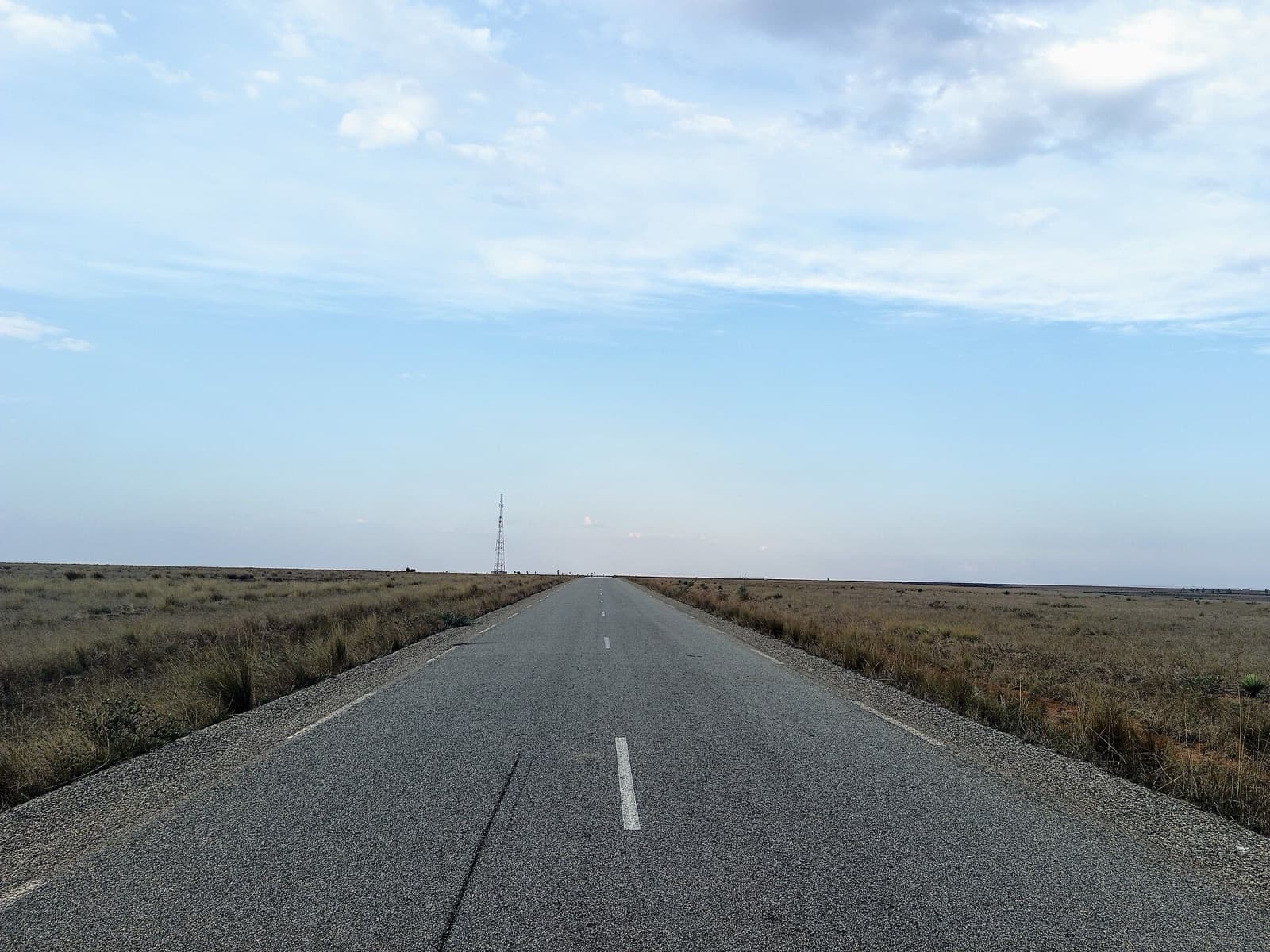
980km, six regions, a country that keeps changing face
The RN7 links Antananarivo to Tuléar (Toliara), crossing six regions — Analamanga, Vakinankaratra, Amoron'i Mania, Haute Matsiatra, Ihorombe and Atsimo-Andrefana — over roughly 980km (some sources give a range of 940 to 1,000km depending on the exact starting point taken in the capital). It's the best-maintained road in the country, which doesn't make it a fast one: a narrow two-lane carriageway that runs straight through every village with no bypass, alternating decent tarmac and rough patches depending on where resurfacing work stands.
The landscape changes almost every hour: terraced rice paddies in the highlands around Antsirabe and Ambositra, mountain rainforest at Ranomafana, zebu-grazed savanna around Fianarantsoa and Ambalavao, then a sharp shift past Ihosy into the red sandstone of Isalo and the spiny vegetation that signals southern Madagascar.
How many days to plan
Driving the RN7 straight through, with no detours, takes 3 to 4 days of actual driving given the road's real speed (see below) — but almost nobody does that, and it would miss the point: the road is worth it for its stops, not its finish line. Plan on 8 to 10 days for a comfortable run south with the essential stops (Antsirabe, Ranomafana, Anja, Isalo), and up to 12-15 days if you add a detour west (the Morondava baobabs, the Tsingy de Bemaraha), which isn't reached via the RN7 itself but by a turnoff near Antsirabe.
Many travellers drive down and fly back from Tuléar, which has an airport with regular flights to Antananarivo — a way to save 2 to 3 days without giving up the drive down.
Stage by stage: the six highlights of the route
Here are indicative distances and driving times between the main stages — a rough guide, not a stopwatch: the RN7 is never driven by the clock, between villages crossed at a crawl and unplanned stops.
| Stage | Distance | Indicative driving time | What to see |
|---|---|---|---|
| Antananarivo → Antsirabe | 170km | 3 to 4 h | Rickshaws, crafts, hot springs |
| Antsirabe → Ambositra → Fianarantsoa | ~200km | 4 to 5 h | Ambositra marquetry, Fianarantsoa cathedral |
| Fianarantsoa → Ranomafana (detour) | ~65km | 1h30 one way | Rainforest, lemurs |
| Fianarantsoa → Ambalavao / Anja | ~55km | 1h30 | Anja's ring-tailed lemurs, zebu market |
| Ambalavao → Ranohira (Isalo) | ~220km via Ihosy | 4 to 5 h | Sandstone canyons, natural pools |
| Ranohira → Toliara (Tuléar) | ~240km via Sakaraha | 4 to 5 h | Isolated baobabs, Indian Ocean |
The road's real condition and average speed
On paper, the RN7 is paved along almost its entire length — a rare privilege in Madagascar, where roughly two-thirds of the secondary road network is considered to be in poor condition. In practice, real average speed sits around 35 to 45 km/h once you account for potholes, zebu carts, village speed bumps and police checks: never plan a trip on a distance calculation made from home.
Night driving is universally discouraged, local drivers included: unlit carts and pedestrians, potholes invisible in the dark, and almost no rescue available if you go off the road after dark. A 2026 study by Katherine Kling and Timothy Eppley, published in the journal Human Ecology, recorded nearly 3,900 daily users on a rural road crossing a special reserve in northeastern Madagascar — pedestrians, cyclists, zebu carts and motorised vehicles sharing the same unlit, undivided carriageway, a finding that applies just as much to the RN7. Leave early, aim to arrive before 5pm, and always keep a margin for a flat tyre or a delayed river ferry.
Driver or self-drive: what changes on the RN7
The RN7 is precisely one of the few roads in the country where self-drive becomes realistic for an experienced driver: mostly paved, signposted through the towns along the way, moderate traffic once clear of Antananarivo's outskirts. That remains the exception rather than the rule: elsewhere in Madagascar, hiring a car with a driver stays the norm — often cheaper than you'd expect, and a real asset for reading police checkpoints, negotiating ferries and finding the best stops.
Either way, carry cash in ariary: cards are accepted almost only in towns, and ATMs become scarce south of Fianarantsoa.
Ranomafana, Anja, Isalo: the parks that punctuate the route
Three protected areas line the RN7, each requiring a compulsory guide plus an entrance fee of roughly 65,000 ariary (about €13) per person per day, on top of the guide's locally set rate: Ranomafana and its lemur-filled rainforest, just over an hour's detour from Fianarantsoa; Anja, a community reserve of ring-tailed lemurs just before Ambalavao; and Isalo, its sandstone canyons and natural pools around Ranohira. Allow at least half a day for each, a night on site if the schedule allows.
The economics of these parks remain fragile and contested. A study by Bruno Sarrasin, published in 2012 in the journal Tourism Geographies, on Ranomafana National Park found that ecotourism revenue, meant to compensate local communities for setting aside their land, ran into a revenue-sharing arrangement seen as insufficient and the suspension of some redistribution mechanisms — fuelling local resentment that ultimately undermines conservation itself (study: doi.org/10.1080/14616688.2012.675512). Paying the full entrance fee without haggling and hiring a locally recruited guide remains the most direct way to make sure these fees actually reach the villages living along the road.
Fuel and supplies along the route
Petrol stations line the RN7 in every stage town (Antsirabe, Ambositra, Fianarantsoa, Ambalavao, Ihosy, Ranohira, Sakaraha), but they can run dry in remote stretches: fill up as soon as the tank drops below half, don't wait for the reserve. Fuel prices are set by the government and revised upward frequently: as a rough guide in mid-2026, expect 5,000 to 7,000 Ar per litre of petrol (slightly less for diesel) — check the price posted at the pump on the day, as it shifts quickly month to month.
Travel tips
Get our independent-travel tips by email
The house methods — costed budgets, driving, itineraries — straight to your inbox. Instant bonus: our free excerpt “The 7 mistakes to avoid on a first Namibia road trip” and the current promo code.
No time to do it yourself?
A professional can take care of it: tailor-made trip, equipped 4x4 rental or a local guide. Describe your plans and, with your consent, we pass them on to partner professionals.
1. What you need
Before you go
Readers' questions
How many days does the whole RN7 take?
Plan on a minimum of 3 to 4 days of pure driving between Antananarivo and Tuléar given the road's real speed, but 8 to 10 days to fit in the stops that make the trip worthwhile (Antsirabe, Ranomafana, Anja, Isalo). Many travellers fly back from Tuléar to save time without giving up the drive down.
Can you drive the RN7 yourself, without a driver?
Yes, it's one of the few roads in the country where self-drive stays realistic for an experienced driver: mostly paved and signposted. It remains the exception in Madagascar though, where hiring a car with a driver stays the most common and often the most practical option.
Do you need a guide to visit the parks along the way?
Yes, a guide is compulsory in all three protected areas on the route (Ranomafana, Anja, Isalo), on top of the roughly 65,000 Ar entrance fee per person per day. The guide's rate is negotiated on site and varies with the length of the chosen route.
Can you drive the RN7 at night?
No, it's strongly discouraged, even by local drivers themselves: unlit carts and pedestrians, potholes invisible in the dark, and almost no rescue available if you go off the road. Leave early in the morning and plan to arrive before dark.
Do you need to go all the way to Tuléar, or can you stop earlier?
It depends on your time budget: Ranohira and Isalo already make a satisfying end point for an 8-10 day trip, with a return to Antananarivo by the same road. Pushing on to Tuléar adds the Indian Ocean and the isolated coastal baobabs, with the option of a direct flight back to the capital from Toliara airport — useful for saving 2 to 3 days on the return leg.