The complete offer · Botswana
Botswana by 4x4: self-drive circuits day by day, campsites included
For you if you are driving Botswana in a rented 4x4 without an agency: Moremi, Savuti, the Chobe riverfront, and the pans if you have three weeks.
You get 2 items:
- 1.The “Botswana on your own” guide · 10 chapters, in French
- 2.The 10, 14 or 21-day roadbook · 31-page PDF, 3 GPX + 3 KML, EN and FR
€89 VAT included
One .zip file to download as soon as you pay (the link is also emailed to you): the roadbook as a printable PDF, the guide to read on screen or print, GPS tracks for Organic Maps, OsmAnd or Google My Maps.
14-day money-back guaranteeone email, no questions asked, refunded within 48 working hours
Card, Apple Pay or Google Pay on Stripe’s secure pageone-time payment
After you pay
- Right away: the PDF downloads from the confirmation page.
- By email: a message from “Partir en liberté”, subject “Your download:” followed by the product’s name, with the link to keep (it stays valid).
- Later: Find my purchases · No phone calls: everything happens online and by email. Questions: admin@tech-bharat.com
The Botswana guide is sold on its own for €44 (in French). The roadbook and its GPS tracks are only sold in this offer.
€89 VAT included · One payment · Instant download · 14-day guarantee
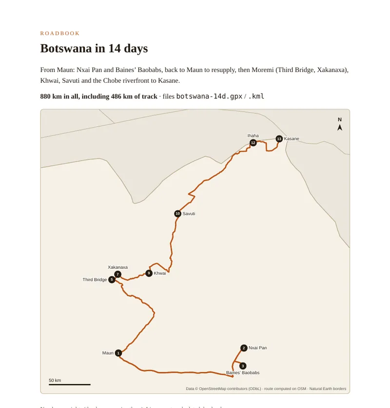
A Botswana self-drive by 4x4 covers 499 km in 10 days, 880 km in 14 days and 1,490 km in 21 days on our three circuits, half or more of it on tracks, with up to 499 km of road between two fuel stations, not counting game-viewing kilometres. The roadbook in this offer spells it out, day by day: each day with its track and tar kilometres, driving time with a margin for sand, fuel stations on the route, veterinary checkpoints, the night's campsite with its operator, contact and published rate, and the GPS track to load offline. With the guide to decide and prepare, every morning you know where to refuel and when to pass the park gate.
In pictures
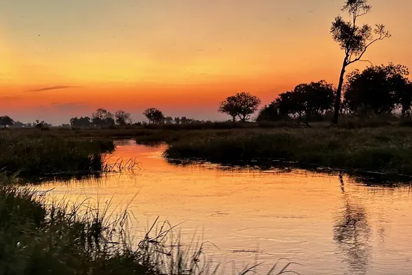
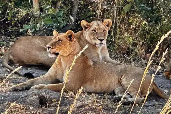
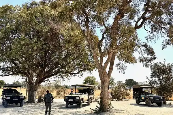
Illustrative photos, published by their authors under free licences.
What you get
1.The “Botswana on your own” guide
10 chapters · in French · €44 on its own
Why Botswana on your own, when to go (the flood and the rains), renting a 4x4, driving in sand and water, booking campsites, the budget item by item, camping without fences, health, safety and borders, and the final checklists.
See the contents →2.The roadbook for the 10, 14 and 21-day circuits
exclusive · 31-page PDF + 3 GPX + 3 KML · EN and FR
Up front, the practical sheets: sunrise and sunset in Maun, Kasane and Savuti with park gate times; month-by-month climate (1996-2025 normals); a booking planner for every departure month (when to write, when to pay the balance, from when cancelling costs); the circuits' campsites with their operator (Xomae, SKL, Kwalate, Gaing-O), contact and published rate; the northern border posts with their phone numbers; veterinary checks according to the official texts. Then one map per circuit and every day: legs, track and tar kilometres, driving time and a time with a 25% margin, fuel stations, distance between fill-ups, mapped veterinary checkpoints, the night to book. At the end: a booking tracker and morning checklist.
The three circuits in figures
| Length | Start → finish | Distance | Of which track | Driving | Nights in park campsites | Between fill-ups, at most |
|---|---|---|---|---|---|---|
| 10 days | Kasane → Maun | 499 km | 383 km | 16 h 42 | 8 | 497 km |
| 14 days | Maun → Kasane | 880 km | 486 km | 24 h 54 | 10 | 499 km |
| 21 days | loop from Maun | 1,490 km | 753 km | 36 h 57 | 14 | 499 km |
Calculated on 28 October 2026 on the road network of the OpenStreetMap extract of Botswana dated 27 October 2026 (cautious speeds given in the roadbook). Pure driving times, without stops; the roadbook adds a 25% margin per day. “Between fill-ups”: road distance between two reliable stations, park days included, game-viewing kilometres excluded; the small Ngoma pump, often reported dry, is not counted.
To prepare, free on the site
Who is it for?
- You are driving Botswana in a rented 4x4 without an agency and want to plan it in one go.
- You can't choose between 10, 14 and 21 days: the roadbook shows what each length means, day by day.
- You want to know whom to write to for each night: every campsite has its operator, contact and published rate.
- You want offline GPS tracks, because there is no mobile signal in the parks.
Figures you can check
Distances and times: calculated on the OpenStreetMap road network (© OpenStreetMap contributors, ODbL), Geofabrik extract of Botswana dated 27 October 2026. Fuel stations and veterinary checkpoints: same extract. Campsites: websites of Xomae Group, SKL Group of Camps and the Gaing-O Community Trust, checked on 28 October 2026. Border posts: Botswana customs (BURS) offices and Daily News, the government news agency. Veterinary checks: Botswana Auditor General's report (2018) and the Ministry of Lands and Agriculture statement of 31 January 2026. Climate: ERA5 reanalysis (Copernicus) via Open-Meteo. Daylight: astronomical calculation, Botswana time (UTC+2). No photo or map generated by AI.
Ready for the sand?
Only want the guide? The €44 Botswana guide (in French) →
How it works
- You pay on Stripe. Card, Apple Pay or Google Pay, one-time payment; your card details never touch our servers.
- You download right away. The link appears on the confirmation page, is also sent by email and stays findable at any time (“Find my purchases”, at the bottom of every page).
- 14-day money-back guarantee. Not for you? On simple request, no questions asked: email admin@tech-bharat.com, full refund within 48 working hours.
Before you go
Readers' questions
What exactly is in the offer?
Two items in a single download: the “Botswana on your own” guide (10 chapters, in French) and the roadbook for the 10, 14 and 21-day circuits from Maun or Kasane (31-page A4 PDF plus an HTML version, in English and French, with 3 GPX and 3 KML files).
Is the roadbook sold on its own?
No. The roadbook and its GPS tracks are only sold in this offer. The “Botswana on your own” guide is still sold on its own at €44.
Where do the distances, campsites and rates come from?
The public OSRM engine ignores most tracks in Botswana's parks, so we calculated every leg on 28 October 2026 on the road network of the OpenStreetMap extract of Botswana dated 27 October 2026, with cautious speeds written in the roadbook (25 km/h on tracks, 20 km/h in sand). Fuel stations and veterinary checkpoints come from the same extract. Campsite operators, contacts and rates were checked on 28 October 2026 on the Xomae, SKL and Gaing-O Community Trust websites; where an operator does not publish its rates, the roadbook says so.
How do I use the GPX files offline?
Open the .gpx file for your trip length in an offline navigation app (Organic Maps, OsmAnd, Gaia GPS) after downloading the Botswana map: one track per day, nights as waypoints with the campsite operator. The .kml imports into Google My Maps and then shows in the Google Maps app.