The complete offer · Scotland
Scotland by car: single-track roads, day by day
For you if you are renting a car or a campervan in Scotland, for Skye, the Highlands or the north coast, and want to know before you go where the road turns single-track, which ferry to take and when the midges are out.
You get 2 items:
- 1.The “Écosse en autonomie” guide · 10 chapters, in French
- 2.The single-track roads, ferries, weather and midges file, 7, 10 or 14-day roadbook · 35-page PDF, 3 GPX + 3 KML, EN and FR
€89 VAT included
One .zip file to download as soon as you pay (the link is also emailed to you): the file as a printable PDF, the guide to read on screen or print, GPS tracks for Organic Maps, OsmAnd or Google My Maps.
14-day money-back guaranteeone email, no questions asked, refunded within 48 working hours
Card, Apple Pay or Google Pay on Stripe’s secure pageone-time payment
After you pay
- Right away: the PDF downloads from the confirmation page.
- By email: a message from “Partir en liberté”, subject “Your download:” followed by the product’s name, with the link to keep (it stays valid).
- Later: Find my purchases · No phone calls: everything happens online and by email. Questions: admin@tech-bharat.com
The Scotland guide is sold on its own for €44 (in French). The file and its GPS tracks are only sold in this offer.
€89 VAT included · One payment · Instant download · 14-day guarantee
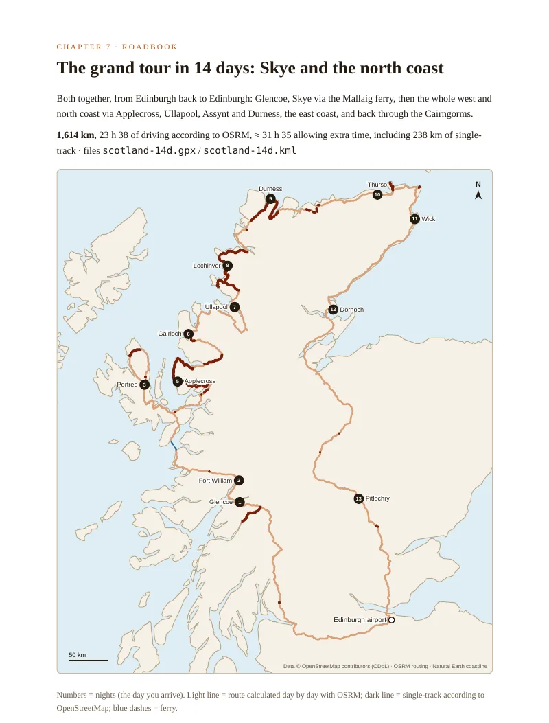
On the west and north coast, much of the road is single-track: 238 km on our 14-day grand tour, located stretch by stretch in OpenStreetMap, the longest stretch being 31.7 km on the B869. The file in this offer gives the exact Highway Code rules and what to do in each situation, then, day by day, where the single-track roads are and what they cost in time. The 5 CalMac ferries that matter, with crossing time, fare and check-in time. The weather month by month in 6 places and what three published studies say about midges: the season, the time of day, the wind. And the roadbook, day by day: 971, 907 or 1,614 km of road, the fuel stations on the route, the night to book and the GPS track to load offline.
In pictures
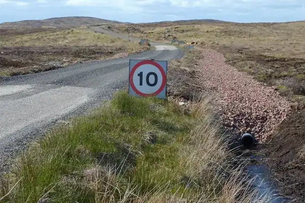
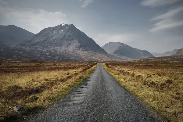
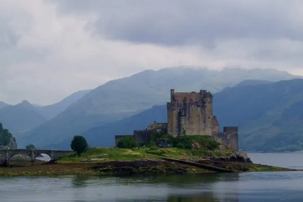
Illustrative photos, published by their authors under free licences.
What you get
1.The “Écosse en autonomie” guide
10 chapters · in French · €44 on its own
Why Scotland on your own, when to go month by month, renting a car or a campervan (insurance, excess and traps), driving on the left and single tracks, the 7, 10 and 15-day itineraries, where to sleep from wild camping to B&Bs, CalMac ferries and the islands, midges, weather and gear, the budget item by item, paperwork, health and checklists.
See the contents →2.The “Scotland by car” file
exclusive · 35-page PDF + 3 GPX + 3 KML · EN and FR
Chapter 1, single-track roads: Highway Code rules 155 and 156, what to do in each situation (passing place on the left or right, uphill, reversing, being overtaken, animals), speed, alcohol and phone; then the single-track stretches of our circuits, located in OpenStreetMap: the fifteen longest stretches, each day's share of single-track and what it costs in time. Chapter 2, the 5 CalMac ferries that matter: crossing time, fare, check-in time, winter and motorhome rules. Chapter 3, the weather month by month in 6 places (rain, temperatures, wind, calm days) and the midge season from three published studies. Chapter 4, fuel and daylight. Then the 7, 10 and 14-day roadbooks, one map per circuit and every day: legs, kilometres, driving time, single-track, fuel stations, the night to book. At the end: budget, booking tracker, checklists and sources.
Contents of the file
- Using this file · the three circuits compared
- 1. Single-track roads: the rules, and where they are · Highway Code, situation by situation, speed and alcohol, the stretches on our circuits, the time they cost
- 2. The CalMac ferries that matter · Mallaig–Armadale, Uig–Tarbert, Uig–Lochmaddy, Ullapool–Stornoway, Oban–Craignure, common rules
- 3. Weather and midges, month by month · rain, temperatures, wind, what the studies say, the midges, calm and daylight calendar
- 4. Fuel and daylight · prices, fuel stations on the circuits, sunrise and sunset
- 5. Glencoe, Skye and Loch Ness in 7 days · Loch Lomond, Glen Etive, the Mallaig ferry, Trotternish, Eilean Donan, the Cairngorms
- 6. The north coast in 10 days · Applecross, Torridon, Ullapool, Assynt, Durness, Dunnet Head, the east coast
- 7. The grand tour in 14 days: Skye and the north coast · Glencoe, Skye, the whole west and north coast, back through the Cairngorms
- Budget, bookings and checklists · petrol and ferry per circuit, booking tracker, checklists, sources
The three circuits in figures
| Length | Start → finish | Distance | Driving | Allowing extra time | Single-track | Petrol (estimate) | Without fuel, at most |
|---|---|---|---|---|---|---|---|
| 7 days | Edinburgh → Edinburgh, via Skye | 971 km | 13 h 53 | 18 h 00 | 58 km | £110 | 73 km |
| 10 days | Inverness → Inverness, north coast | 907 km | 13 h 46 | 18 h 45 | 208 km | £103 | 74 km |
| 14 days | Edinburgh → Edinburgh, Skye and north coast | 1,614 km | 23 h 38 | 31 h 35 | 238 km | £183 | 74 km |
OSRM distances and times of 3 November 2026, no stops. Allowing extra time: single-track counted at 40 km/h and a 25% margin on the rest (our assumption, stated in the file). Single-track and fuel stations: OpenStreetMap of 3 November 2026, stations within 500 m of the road. Petrol: 6.5 l/100 km at the UK average price of 26 October 2026 (DESNZ).
To prepare, free on the site
Who is it for?
- You have never driven a single-track road and want to know exactly who pulls in, who reverses and where you may not stop.
- You are planning Skye, Applecross or the North Coast 500 and want to know, day by day, how many kilometres are single-track and how much time to allow.
- You can't decide on the month: you want rain, wind and the midge season, in figures and sourced, before you book.
- You want to take the Mallaig ferry (£13.25 for the car, £4.00 per adult, 30 min) or push on to the Hebrides, and want offline GPS tracks with nights as waypoints.
Figures you can check
Rules: The Highway Code (gov.uk), rules 124, 149, 154 to 156, 214 and 215; drink-drive limits (gov.uk). Single-track roads, passing places and fuel stations: OpenStreetMap (© OpenStreetMap contributors, ODbL), data of 3 November 2026. Distances: OSRM on OpenStreetMap, calculated on 3 November 2026. Ferries: CalMac, route pages and winter 2026/27 timetables, checked on 3 November 2026. Weather: ERA5 reanalysis (Copernicus / ECMWF), 1996-2025, via Open-Meteo. Midges: Blackwell et al. 1992 (Bulletin of Entomological Research, doi.org/10.1017/S0007485300041055), Blackwell 1997 (Medical and Veterinary Entomology, doi.org/10.1111/j.1365-2915.1997.tb00423.x), Purse et al. 2012 (Medical and Veterinary Entomology, doi.org/10.1111/j.1365-2915.2011.00991.x). Fuel: DESNZ weekly prices of 26 October 2026. No photo or map generated by AI.
Ready for the road?
Only want the guide? The €44 Scotland guide (in French) →
How it works
- You pay on Stripe. Card, Apple Pay or Google Pay, one-time payment; your card details never touch our servers.
- You download right away. The link appears on the confirmation page, is also sent by email and stays findable at any time (“Find my purchases”, at the bottom of every page).
- 14-day money-back guarantee. Not for you? On simple request, no questions asked: email admin@tech-bharat.com, full refund within 48 working hours.
Before you go
Readers' questions
What exactly is in the offer?
Two items in a single download: the “Écosse en autonomie” guide (10 chapters, in French) and the “Scotland by car” file (35-page A4 PDF plus an HTML version, in English and French): the Highway Code rules on single-track roads and what to do in each situation, the single-track stretches of our circuits located one by one in OpenStreetMap, the 5 CalMac routes that matter, the weather month by month in 6 places and the midge season from three published studies, fuel, then the 7, 10 and 14-day roadbooks, with 3 GPX and 3 KML files.
Is the file sold on its own?
No. The file and its GPS tracks are only sold in this offer. The “Écosse en autonomie” guide is still sold on its own for €44 (in French).
How did you locate the single-track roads?
By matching, node by node, the route calculated with OSRM against OpenStreetMap data of 3 November 2026: a kilometre counts as single-track when the road is tagged as one lane there or carries at least one passing place. The result: 58 km on the 7-day circuit, 208 km on the 10-day one, 238 km on the grand tour. OpenStreetMap does not list every passing place: their number, given day by day, is a minimum.
Where do the weather and the midge season come from?
The weather comes from the ERA5 reanalysis (Copernicus / ECMWF), thirty years of daily values (1996-2025). For midges, three published studies cited with their DOI: the dominant species throughout the season studied, May to September (Blackwell et al., 1992), the dawn and dusk peaks, humidity and wind (Blackwell, 1997), the link with wet pasture (Purse et al., 2012). The file does not forecast midges: it says when and where they were observed, and how many calm days each month has.